Maunsell Navy Fort HM Fort Roughs (U1)
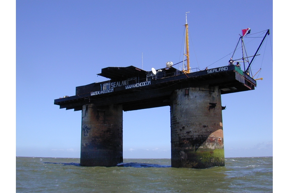

HMF Roughs (U1), HMF Sunk Head (U2), HMF Tongue Sand (U3) and HMF Knock John (U4), known as 'His Majesty's Forts', were built by the Navy and originally had a complement of about 100 men who were assigned to them before deployment. These were designed as a reinforced concrete pontoon measuring 168 by 88 feet supporting two hollow cylindrical towers, 24 feet in diameter, which were topped by a gun deck, an upper deck and a central tower unit which controlled radar equipment. They were constructed in harbour and on completion were towed into position by three tugs and then sunk, leaving only the large diameter towers and platform showing above sea level. They were operable within 30 minutes of 'launching'. The tower 'legs' were divided into seven floors, providing accommodation and storage areas. There was a steel framework at one end supporting a landing jetty and crane which was used to hoist supplies aboard.
HM Fort Roughs (U1) was the first Maunsell Naval Fort to be grounded on Wednesday 11th February 1942 and was sunk in 37 feet of water in just 15 minutes on the Roughs Sand, some 6.0 nautical (6.9) miles off the Felixstowe, Suffolk coast. In 1944 the compliment of men was reduced as the war turned in favour of the allies, a floor was converted into a library, recreation room. Decommissioned on 14th February 1945 the fort was reduced to care and maintenance until 1956.
The Naval Fort was occupied in 1966 by the war veteran Major Patrick "Paddy" Roy Bates who proclaimed the independent state of "Sealand" outside the then applicable 3 mile zone.
On June 23, 2006, a fire broke out on the upper platform due to an electrical fault. In November 2006, repairs to the damaged platform were completed.
Do you have more information about this location? Inform us!
Source
- Text: R. Bronkhorst
- Photos: Ryan Lackey
- Sealand
- BATES, MICHAEL, Principality of Sealand: Holding the Fort, Principality of Sealand, 2015.
Related books


Looking for reliable information or news facts about WW2? Do you want to create your own battlefield tour to sights of wars from the past? Or are you interested in war medals and their recipients? TracesOfWar.com tells you more!
More information

© STIWOT, 1999-2025. All rights reserved. Privacy statement, cookies, disclaimer and copyright