Vector of Memory Operatie Cannonshot
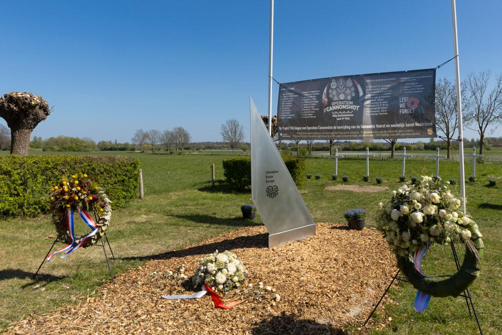

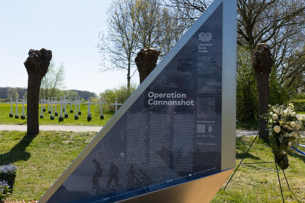
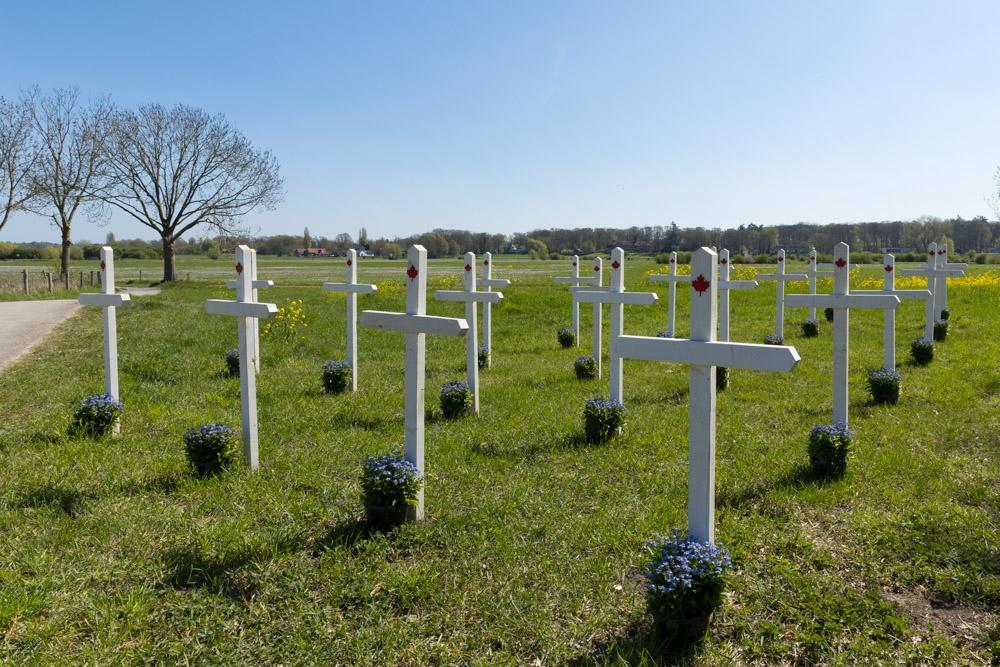
On 11 April 1945, Operation Cannonshot began: the crossing of the IJssel by the Allies. This cleared the way for the liberation of the western Netherlands.
Liberation Route Europe is a certified Cultural Route of the Council of Europe. With hundreds of sites and stories in nine European countries, the route links the main regions along the advance of the Allied Forces in 1943-1945.
The entire route consists of themed routes that can be travelled by by hiking, walking, cycling and car. These routes pass numerous historical and interesting sites and tell stories from a multitude of perspectives that were important in the final phase of World War II.
A separate group within the routes are the Vectors of Memory designed by renowned architect Daniel Libeskind. They form a symbolic family of landmarks that honor people, places and stories in the European landscape. The vectors are a topography of memory. They act as points in both space and time and connect to the liberation story. It is important that the markers convey a clear and powerful message.
There are 4 types of vectors:
- The Remembrance Site Vector
- The Crossroads Vector
- The Wall Vector
- The Floor Vector
For more information on the Vectors of Memory see the Liberation Route Europe site: https://www.lre-foundation.org/vectors-of-memory.
The routes can be found on the website of Liberation Route Europe or in the app through which many stories can also be listened to.
The routes can be found on the Liberation Route Europe website or in the app through which many stories can also be listened to.
Do you have more information about this location? Inform us!
Source
- Text: TracesOfWar
- Photos: Arjan Vrieze

Nearby
Point of interest
- V1 Launch Site Dortherdijk - Joppe
- V1 Launch Site Dortherdijk - Joppe
- PAK-36 Gun Deventer - Deventer
Monument
- Information board Bombing of Gorssel 8 March 1945 - Gorssel
- Memorial Canadian Army Gorssel - Gorssel
- IJssel Crossing Memorial - Wilp (Voorst)
Cemetery
- Dutch War Graves General Cemetery Gorssel - Gorssel
- Commonwealth War Graves General Cemetery Gorssel - Gorssel
- Dutch War Graves Wilp - Wilp (Voorst)
Remembrance Stone
- Stumbling Stone Rietdekkerweg 24 - Gorssel
- Stumbling stone Het Centrum 8 - Deventer
- Stumbling Stones Mr. H.F. de Boerlaan 95 - Deventer
Fortification
Crash site
Looking for reliable information or news facts about WW2? Do you want to create your own battlefield tour to sights of wars from the past? Or are you interested in war medals and their recipients? TracesOfWar.com tells you more!
More information

© STIWOT, 1999-2025. All rights reserved. Privacy statement, cookies, disclaimer and copyright