Bunker Belt Bruggenhoofd Gent – Support Line Bunker D20

Belgian bunker, part of the Ghent Bridgehead. This defensive position was constructed between 1934 and 1938, eight kilometres south of Ghent. Its construction was part of the fortification policy that Belgium pursued after the First World War.
The actual bridgehead consisted of two resistance nests – Betsberg and Muntekouter – and three strong points – Semmerzake, Eke and Astene.
The resistance nests and strong points were connected to each other by a curtain consisting of three defence lines.
There were 11 bunkers on the Melle territory, of which 2 have been demolished. Of the remaining ones, several are on private property or are overgrown.
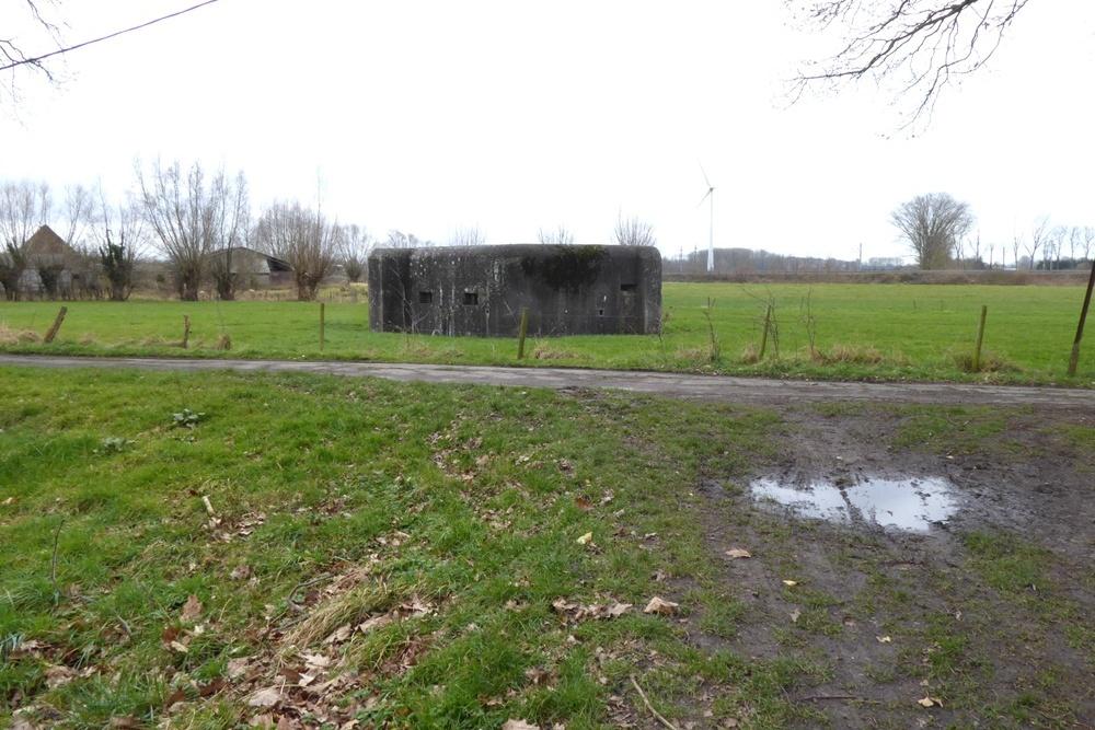
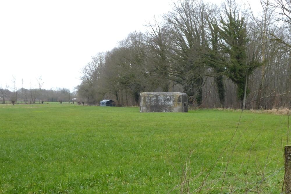
D20 was a support line bunker between the Ostend-Brussels railway line and the Ghent-Aalst road between D19 (445 m) and C18 (475 m).
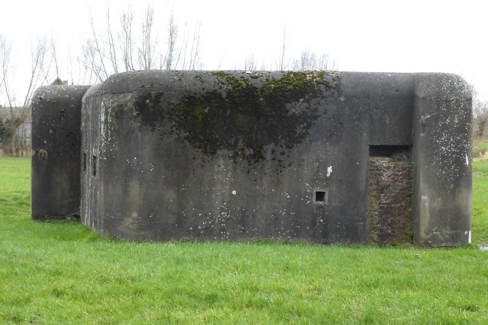
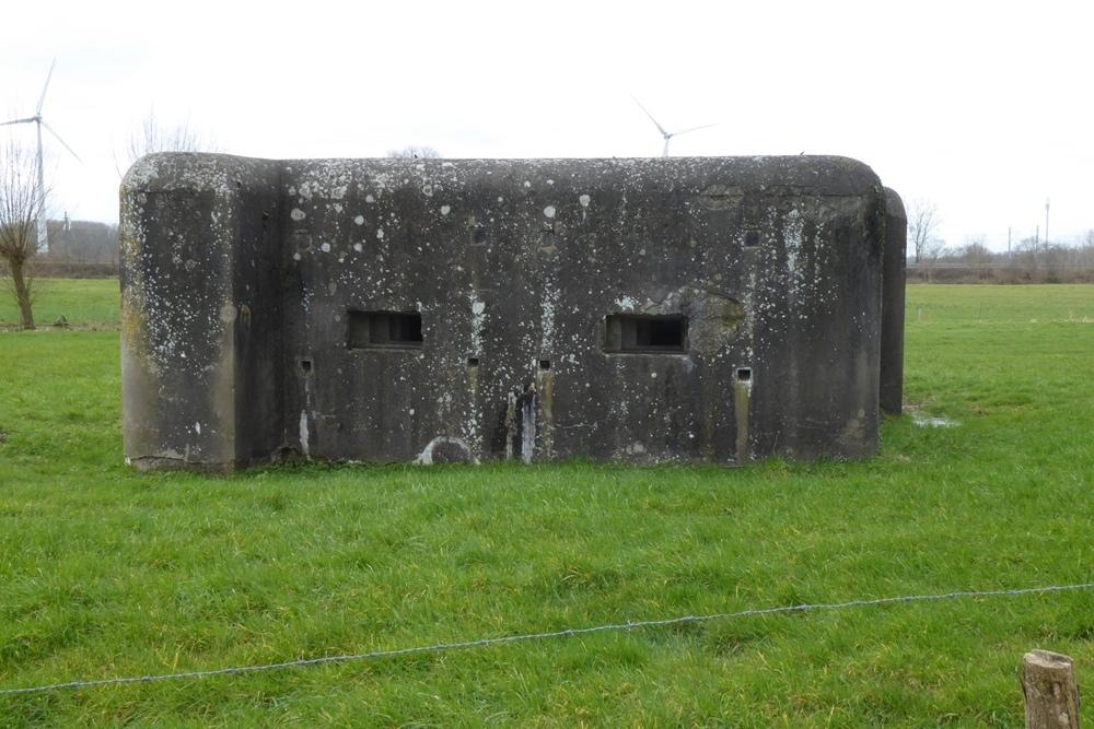
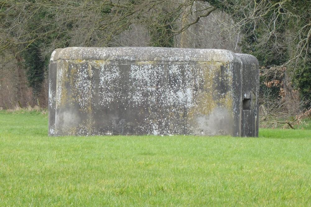
It looked like a smooth block of concrete, cemented all around. There are few to no traces of the battle. Originally it was painted completely green with colour spots of ochre red, ochre yellow, Prussian blue and emerald green. Currently it has a rather dark appearance.
The left loophole and the entrance were somewhat hidden behind an oreillon.
The loopholes were hidden behind metal shutters.
The bunker consisted of two rooms connected at the back and an airlock.
Each room was equipped as standard for mounting a Maxim machine gun but also for mounting a Hotchkiss or Colt machine gun.
Originally it was hidden behind numerous trees and bushes, now it is clearly visible in a meadow.
The bunker is easiest to find via the Aalst – Ghent road.
Past the Kwatrecht viaduct, take the Kalverhagestraat on the left.
From there, take the Geerbos field path where the bunker is located in a meadow, just before the Hof ter Geerbos farm.
Extensive information about this bunker belt can be found on the site Bunkergordel Bruggenhoofd Gent. It also contains photos, plans and technical data of the bunkers. A map shows the locations per municipality.
Do you have more information about this location? Inform us!
Source
- Text: TracesOfWar
- Photos: Marie-Christine Vinck

Nearby
Museum
Point of interest
- Institute Mariagaard Kwatrecht - Kwatrecht (Wetteren)
- Halve Maanroute – information board 3, Battle of Gijzenzele - Gijzenzele (Oosterzele)
- Halve Maanroute – information board 1 Gijzenzele - Gijzenzele (Oosterzele)
Monument
- Memorial 5th Line Regiment Kwatrecht - Wetteren
- Memorial 5th Line Regiment Kwatrecht - Kwatrecht (Wetteren)
- War Memorial Gijzenzele - Gijzenzele (Oosterzele)
Cemetery
- Belgian War Graves Wetteren-Kwatrecht - Kwatrecht (Wetteren)
- Commonwealth War Grave Gijzenzele - Gijzenzele (Oosterzele)
- Belgian War Grave Belgisch Gijzenzele - Gijzenzele (Oosterzele)
Remembrance Stone
- Stumbling Stone Stationsstraat 30 - Wichelen
- Stumbling Stone Wettersestraat 25 - Wichelen
- Stumbling Stone Jacques Eggermontstraat 59 - Ledeberg (Gent)
Fortification
Looking for reliable information or news facts about WW2? Do you want to create your own battlefield tour to sights of wars from the past? Or are you interested in war medals and their recipients? TracesOfWar.com tells you more!
More information

© STIWOT, 1999-2025. All rights reserved. Privacy statement, cookies, disclaimer and copyright