Royal Military Canal
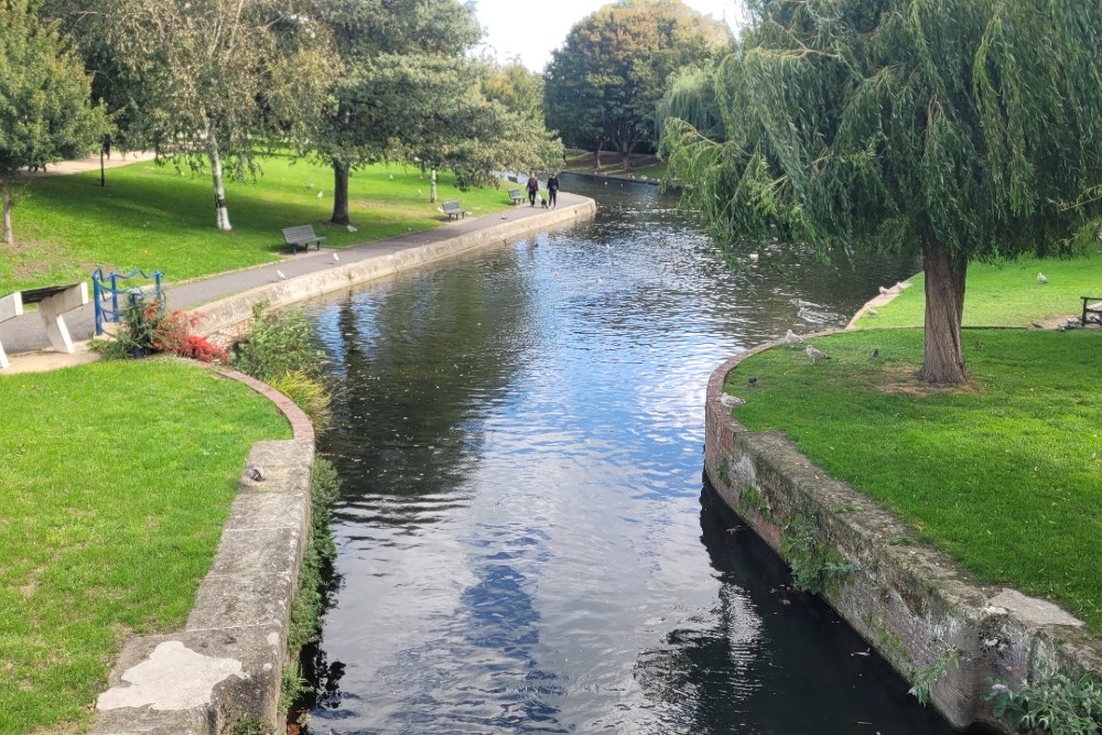

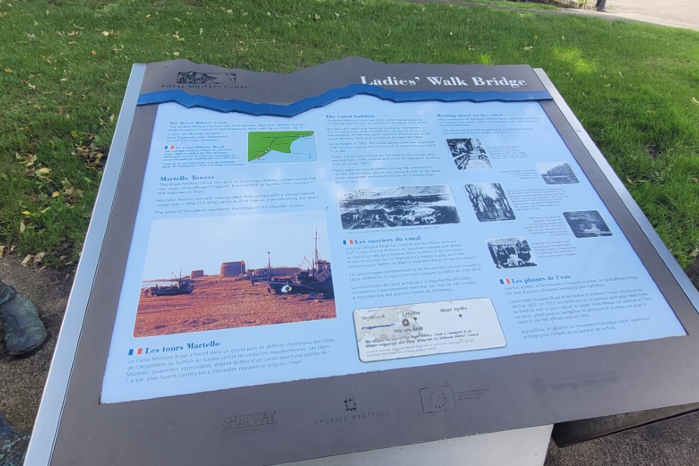
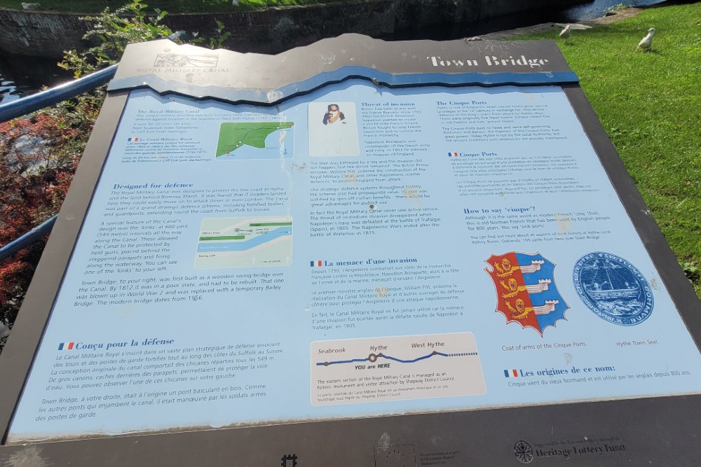
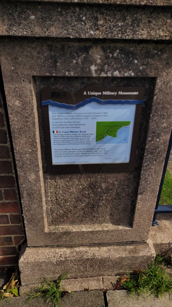
The Royal Military Canal is a canal running for 28 miles (45 km) between Seabrook near Folkestone and Cliff End near Hastings, following the old cliff line bordering Romney Marsh, which was constructed as part of British anti-invasion preparations of 1803–05 against Napoleon's planned invasion of the United Kingdom. It was designed with the intention to tactically contain the potential landing points near to Dungeness, which is approximately 20 miles from Dover and 40 miles from Calais, an area if conquered would provide a direct route to London from the coast.
The canal was conceived by Lieutenant-Colonel John Brown of the Royal Staff Corps of field engineers in 1804, during anti-invasion preparations, as a defensible barrier to ensure that a French force could not use the Romney Marsh as a bridgehead. It had previously been assumed that the marsh could be inundated in the event of an invasion, but Brown argued that this would take ten days to implement and would cause massive disruption in the event of a false alarm. At a meeting on 26 September 1804, the Prime Minister, William Pitt the Younger, and the Commander-in-Chief of the Forces, the Duke of York, both enthusiastically endorsed the scheme. John Rennie was appointed consultant engineer, and Pitt personally persuaded the local landowners to agree to the new canal.
Construction was started at Seabrook, near Hythe in Kent on 30 October 1804. By May 1805 only six miles of the canal had been completed; William Pitt intervened and the contractors and Rennie were dismissed. The work was resumed by the Quartermaster-General’s department with Lt-Col. Brown in command. Civilian navvies dug the canal itself, while soldiers built the ramparts. It was constructed in two sections: the longer section starts at Hythe and ends at Iden Lock in East Sussex; the second, smaller section, runs from the foot of Winchelsea Hill to Cliff End. The two sections are linked by the River Rother (Eastern) and River Brede. Artillery batteries were generally located every 500 yards (460 m), where the canal was staggered to create a salient, allowing the guns to enfilade the next stretch of water. A military road was built on the inland side of the canal, and crossings consisted of moveable wooden bridges. Any troops stationed or moving along the military road would have been protected by the earthen bank of the parapet, which was piled up with excavated soil. The canal was completed in April 1809 at a total cost of £234,000; it was hoped that tolls for use of the waterway and road would help to defray the cost. In addition to these works, a number of Martello towers were built to protect the vulnerable sluices that controlled the water level in the canal, being towers numbers 22 to 27 and 30, three of which are still standing.
Do you have more information about this location? Inform us!
Source
- Text: Sharky Ward
- Photos: Anthony (Sharky) Ward

Nearby
Museum
Point of interest
- Clock Tower Christ Church - Folkestone
- Memorial Walter Tull - Folkestone
- Phoenix Caisson - Littlestone-on-Sea
Monument
Cemetery
- Commonwealth War Grave St. Leonard Churchyard - Hythe
- Commonwealth War Graves St Peter and St Paul Churchyard - Saltwood
- Commonwealth War Graves Horn Street Burial Ground - Hythe
Fortification
Looking for reliable information or news facts about WW2? Do you want to create your own battlefield tour to sights of wars from the past? Or are you interested in war medals and their recipients? TracesOfWar.com tells you more!
More information

© STIWOT, 1999-2025. All rights reserved. Privacy statement, cookies, disclaimer and copyright