Historical Route Bastogne 6


The Historical Route Bastogne is a route surrounding Bastogne with 15 information boards.
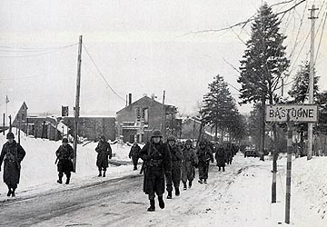
On December 20, 1944, the first confrontation between a unit of the Panzer Lehr (which further encircled Bastogne) and Company C of the Engineer Battalion of the 101st Airborne and the O’Hara team took place.
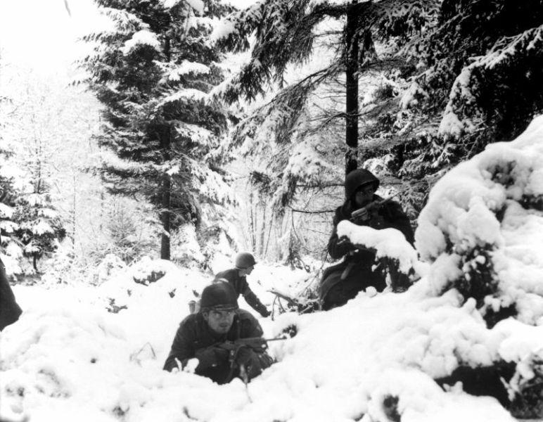
Coming from the woods of Marenwez, the Germans repeatedly try to take the burning village and on Christmas Eve reached the brook that cuts the village in two.
As a result of the American troop movements, the 6th Armored Division was finally able to clear the area.
The civilian population in the village and the surrounding area, tossed back and forth between the fighting parties, paid a heavy toll in human lives as they tried to escape the fighting.
American veteran Leo LeBlanc, who has since became a citizen of Bastogne, spent Christmas night in the barn of the Nisen farm. He remembered a bomb that, without exploding, went through the thick wall and deafened him for a moment. In 1999, he met American pilots who bombed the village and came face to face with the men who nearly killed him.
The village is liberated on January 9, 1945.
To reach information board 7
Make your way through the village and continue along the road until you reach the last houses (to the right) and a farm (to the left). Take the cemented road towards the right to the crossroads. Go towards the left, past Lutrebois and continue on towards Lutremagne. In this village, follow the direction to Villers-La-Bonne-Eau and pull over close to the church.
Do you have more information about this location? Inform us!
Source
- Text: Historische Route Bastogne
- Photos: Barry van Veen
Related books


Nearby
Museum
- Bastogne War Museum - Bastogne
- 101st Airborne Museum Le Mess - Bastogne
- Bastogne Barracks (Headquarter Gen. McAuliffe) - Bastogne
Point of interest
- Sherman Turret Marvie - Marvie
- Remains Sherman Turret Direction Wiltz - Bastogne
- Sherman Turret Direction Wiltz - Bastogne
Monument
- Memorial 327th Glider Infantry Regiment - Marvie
- Monument 501st PIR - 101st Airborne Division - Mont (Bastogne)
- Battlefield Marker Remoifosse - Bastogne
Cemetery
- Belgian Graves Veterans Marvie - Marvie (Bastogne)
- Belgian War Graves Marvie - Marvie (Bastogne)
- Belgian War Grave Bastogne - Bastogne
Fortification
Looking for reliable information or news facts about WW2? Do you want to create your own battlefield tour to sights of wars from the past? Or are you interested in war medals and their recipients? TracesOfWar.com tells you more!
More information

© STIWOT, 1999-2025. All rights reserved. Privacy statement, cookies, disclaimer and copyright