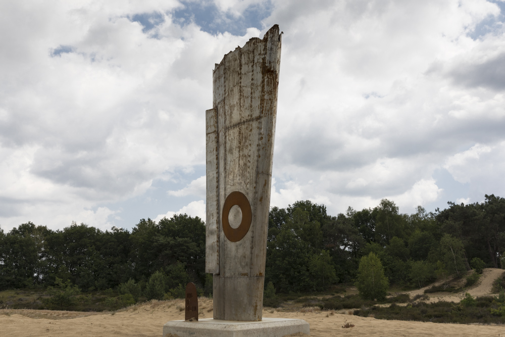
Cycle Route Wings of Freedom: Crash Site Typhoon Mk Ib, JR497, Code F3
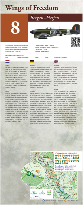

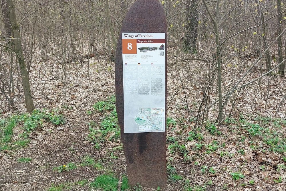
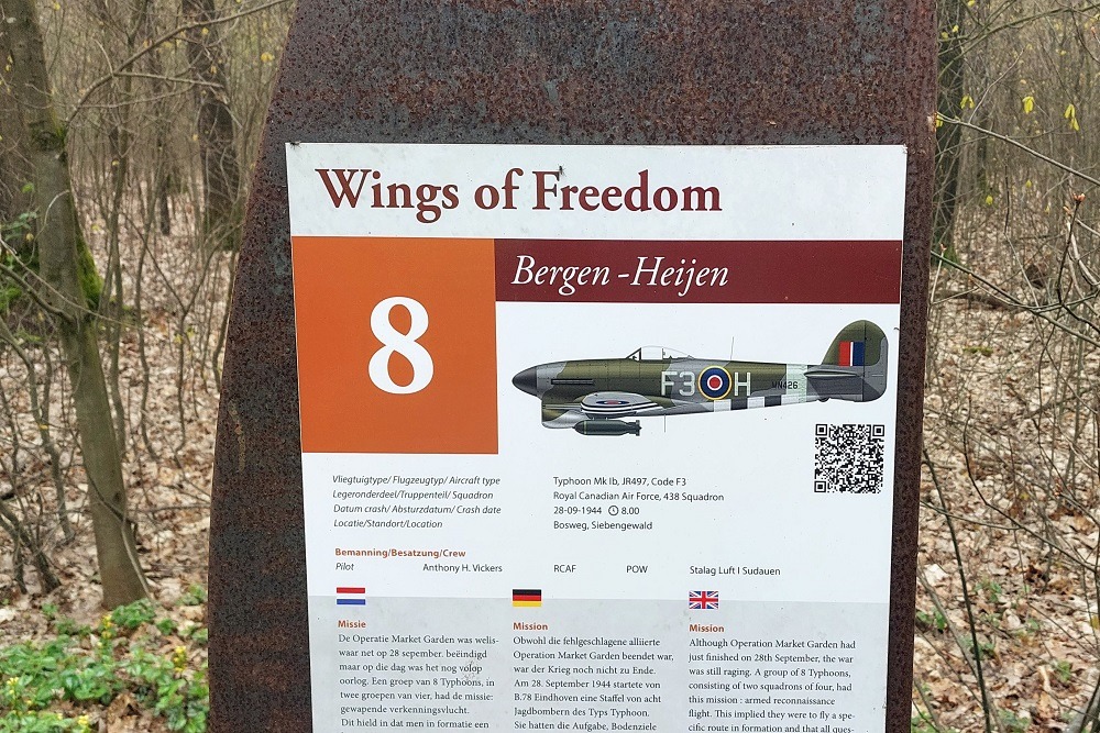
Although Operation Market Garden had just finished on 28th September, the war was still raging. A group of 8 Typhoons, consisting of two squadrons of four, had this mission: armed reconnaissance flight. This implied they were to fly a specific route in formation and that all questionable objects, such as trains, ships/boats, columns and transports were to be shot at.
Three out of the eight were (slightly) hit by anti-aircraftguns: one plane made an emergency landing near the Bosweg (Woodroad) in Siebengewald, another one fell to the ground at the Nieuwe Erf near Heijen and the third one came down on German territory. The Typhoon that had come down near the Bosweg was lying close to the house of the Holtmeulen family. The pilot, Anthony H. Vickers, was only slightly injured and tried to set fire to his plane with his parachute. He was quickly taken prisoner and transported to Germany across the border by five Germans. The German soldiers were on bikes, but the pilot was forced to walk and sometimes got even kicked to hurry him along.
The crash took place at the coordinates: 51.658076, 6.040974.
In collaboration with the municipalities of Bergen, Gennep, Mook-Middelaar and Weeze, the initiative was created for cycling routes 'Wings of Freedom' along crash locations.
In the four municipalities, 28 crash sites have been definitively confirmed. Near each crash site is a memorial sign with information about the cause of the crash. Using the network of cycling nodes, there are four routes of approximately 30 - 40 km. deployed along these places.
Do you have more information about this location? Inform us!
Source
- Text: Werkgroep Wings of Freedom
- Photos: Werkgroep Wings of Freedom (1), Peter Schipper (2, 3, 4)
- Vliegtuigcrashroute Wings of Freedom

Nearby
Museum
- Museum "Van Postzegel tot Tank" - Groeningen
- Royal Air Force Museum Airport Weeze - Weeze
- Exposition 40-45 - Blitterswijck
Point of interest
- Cycling Route Maashees - Camp on the Heath - Maashees
- Castle Bleijenbeek - Afferden
- Cycling Route Maashees - Bunkers Maaslinie - Maashees
Monument
- Cycle Route Wings of Freedom: Central Memorial - Nieuw Bergen
- Memorial Gerardus G.H. Derks - Afferden
- Maria chapel - Maashees
Cemetery
- Dutch War Graves Venray - Venray
- Dutch War Graves Roman Catholic Cementery Blitterswijck - Blitterswijck
- Dutch War Grave Roman Catholic Cemetery Wellerlooi - Wellerlooi
Remembrance Stone
- Stumbling Stones Leeger-Weezer-Weg - Goch
- Stumbling Stone Hinterm Engel 20 - Goch
- Stumbling Stones Voßstraße 12 - Goch
Crash site
Looking for reliable information or news facts about WW2? Do you want to create your own battlefield tour to sights of wars from the past? Or are you interested in war medals and their recipients? TracesOfWar.com tells you more!
More information

© STIWOT, 1999-2025. All rights reserved. Privacy statement, cookies, disclaimer and copyright