Memorial Battle 6 to 12 June 1944
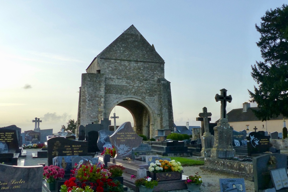

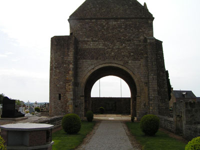
The war memorial of Graignes is located at the Place de la Libération. It commemorates the fallen civilians and soldiers who died after the invasion. Some of the civilian victims are buried behind the memorial.
At about 2 am on June 6, 1944, 170 paratroopers of the U.S. 82nd Airborne Division parachuted into the flooded marsh land around Graignes, about 20 kilometers south of their target, Anfreville.
After regrouping, thanks to their metal clickers know as "crickets", they headed towards Graignes. German forces had spotted them, but there were no Germans in the community and with the help of the citizens they treated their wounded and packed up provisions for the battle to come. The liberators cut off the town and occupied the trenches around it. The school was used as a command station and the church bell tower as an observation post.
Fighting began on the evening of Saturday, June 10 when an American paratrooper shot two Germans approaching the town on motorcycle and side-car. The next day has become known as "Bloody Sunday" in Graignes. Around 10 am, while the paratroopers were attending Mass with the local citizens, the Germans launched the first attack. A little before nightfall, after the third assault and as the Americans were running short of ammunition, the German forced seized control of the town. Several G.I.S. were captured or killed; the others went into hiding and managed to flee later through the surrounding marsh land. The prisoners were executed.
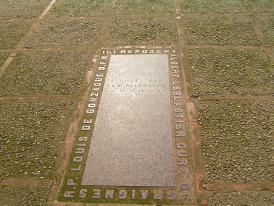
Having suffered very heavy losses, the Germans launched reprisals, throwing citizens from their homes, pillaging the town and even executing civilians including Abbot Leblastier, the local priest.
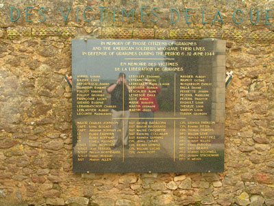
Graignes was liberated on July 12, after artillery shelling from both sides. About 30 Americans died in the fighting; every building in the community was damaged and on third of them were completely destroyed.
Do you have more information about this location? Inform us!
Source
- Text: Paul de Wijs
- Photos: Randy Brandt (1) & Paul de Wijs (2,3,4)

Nearby
Museum
- Normandy Victory Museum - Catz/St Pellerin
- Memorial Museum of Bloody Gulch - Méautis
- D-Day Experience - Dead Man's Corner Museum - Saint-Côme-du-Mont
Point of interest
- Information Panel Graignes - Graignes-Mesnil-Angot
- Church Saint-Georges-de-Bohon - Saint-Georges-de-Bohon
- Panzerabwehrkanone 40 Le Dézert - Le Dézert
Monument
- War Memorial Graignes - Graignes-Mesnil-Angot
- Monument 507th Parachute Infantry Regiment - Graignes-Mesnil-Angot
- War Memorial Saint-André-de-Bohon - Saint-André-de-Bohon
Cemetery
Looking for reliable information or news facts about WW2? Do you want to create your own battlefield tour to sights of wars from the past? Or are you interested in war medals and their recipients? TracesOfWar.com tells you more!
More information

© STIWOT, 1999-2025. All rights reserved. Privacy statement, cookies, disclaimer and copyright