Betinkingsrûte WWII '40-'45: Information board 2, De Kninepôle
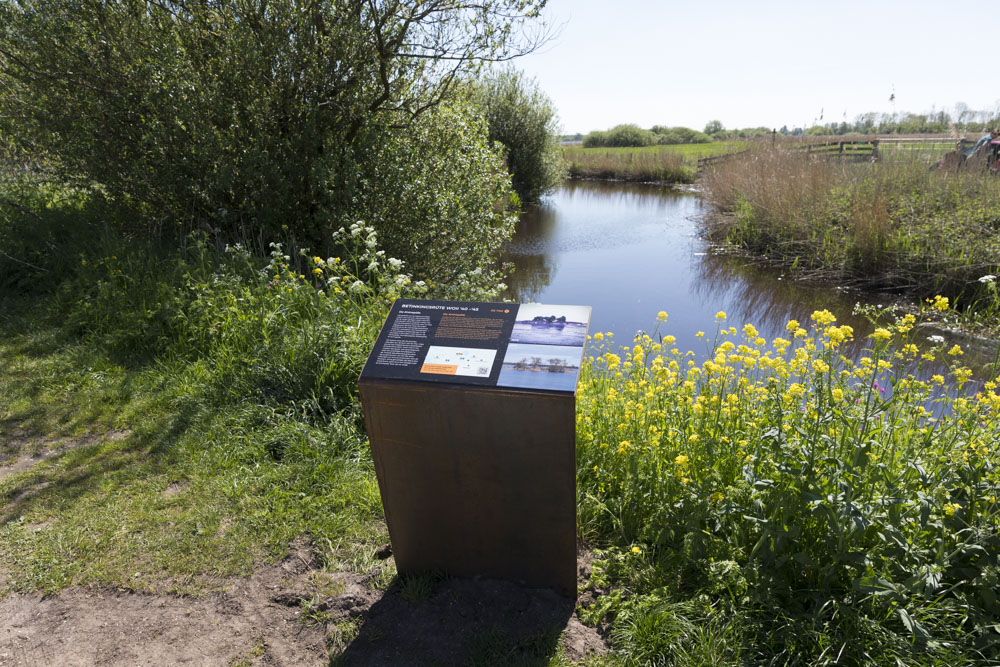

This information board is part of the Betinkingsrûte WOII '40-'45, unveiled in 2025. During the Second World War, young men used the peat area here to hide from the German occupiers.
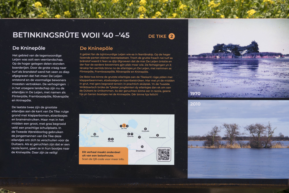
The Kninepôle
The area that is now Leijen was once a peat landscape. Farms stood on the higher ground. Due to the high demand for peat as fuel, the peat was dug so deep that the lake De Leijen was created and the former residents had to leave. The elevations in the former landscape are now the islands in De Leijen, with names such as Flinterpôle, Framboazepôle, Rôverspôle and Kninipôle.
The last two are the largest islands on the side of De Tike: rough ground with poplar trees, alder groves and blackberry bushes. But in the middle is a large field covered with grass: a wonderful hiding place. During World War II, the young men of De Tike used these islands to hide from the Germans. When rumours of a raid spread, they took their boats to Kninipôle. There they were safe.
Do you have more information about this location? Inform us!
Source
- Text: TracesOfWar
- Photos: Arjan Vrieze

Nearby
Museum
Point of interest
- Betinkingsrûte WWII '40-'45: Information board 1, Walter WInce - De Tike
- Betinkingsrûte WWII '40-'45: Information board 7, Sack-Time Sally: crash on 26 November 1943 - Opeinde
- Betinkingsrûte WWII '40-'45: Information board 10, Kloosterman - Earnewald
Monument
- Memorial Rienk Talstra - Oostermeer
- War Memorial Opeinde - Opeinde
- Bell Stand Protestant Cemetery Opeinde - Opeinde
Cemetery
- Commonwealth War Graves Protestant Cemetery Opeinde - Opeinde
- Dutch War Graves Protestant Cemetery Opeinde - Opeinde
- Commonwealth War Graves Protestant Churchyard Rottevalle - Rottevalle
Remembrance Stone
- Stumbling Stones Stationsweg 113a - Drachten
- Stumbling Stones Beter Wonen 19 - Drachten
- Stumbling Stones Kerkstraat 3 - Drachten
Crash site
Looking for reliable information or news facts about WW2? Do you want to create your own battlefield tour to sights of wars from the past? Or are you interested in war medals and their recipients? TracesOfWar.com tells you more!
More information

© STIWOT, 1999-2025. All rights reserved. Privacy statement, cookies, disclaimer and copyright