Stelling van Amsterdam - St. Aagtendijk


St. Aagtendijk dates back to the Middle Ages (13th century) and has a wide inundation canal and defensive moat on its west side. During the construction of the Defence Line of Amsterdam, the northern route was adjusted and a sandbox was placed underground.
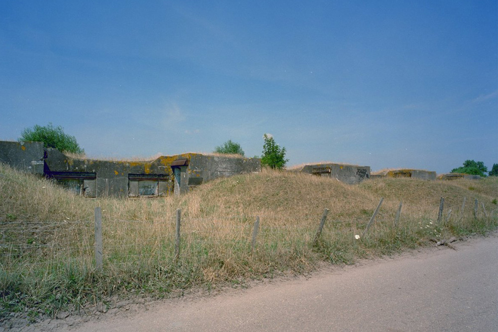
Five dams span the canal, two of which have original cast-iron tubes. A sixth dam disappeared during the construction of the A9 motorway. A battery for 6cm artillery was located near the gas station. On the east side runs the Genieweg, a covered route for troop movements. A secondary battery with three guns and four ammunition depots is located in the dike.
On July 7, 1944, the Albrecht resistance group reported a German occupation with approximately 30 machine gun posts, some manned by "Herman Göring" troops. The inundated area east of the embankment was marked with "Minengefahr" (Mining Fahr) signs.
The dike profile is largely intact, with visible soil deposits, pollarded willows, and boundary markers. The A9 highway lies immediately to the west.
Do you have more information about this location? Inform us!
Source
- Text: TracesofWar
- Photos: TracesofWar
- - stelling-amsterdam.nl

Nearby
Museum
- Air War Museum Fortress Veldhuis - Heemskerk
- Air War Museum Icarus et Mars 1940-1945 - Assendelft
- Werkgroep "Oud-Castricum" - Castricum
Point of interest
- Stelling van Amsterdam - Engineering Shed Fort bij Veldhuis - Heemskerk
- Military Depot Fort aan den Ham - Uitgeest
- Stelling van Amsterdam - Fort Guards House Fort aan de St. Aagtendijk - Beverwijk
Monument
- Memorial Stone Protestant Churchyard Heemskerk - Heemskerk
- War Memorial Protestant Churchyard Heemskerk - Heemskerk
- Dutch East Indies Memorial Beverwijk - Beverwijk
Cemetery
- Commonwealth War Graves Protestant Churchyard Heemskerk - Heemskerk
- Grave Memorial R.C. Cemetery Assendelft - Assendelft
- Dutch War Graves Reformed Cemetery Assendelft - Assendelft
Remembrance Stone
- Stumbling Stone Anna van Renesselaan (was Kleis 6) - Uitgeest
- Stumbling Stone Hoflanderweg 54 - Beverwijk
- Memorial Stone Munnikenweg 37 - Beverwijk
Fortification
- Nevenbatterij Fort Veldhuis - Heemskerk
- Atlantikwall - FA Küche - Heemskerk
- Atlantikwall - OB Scheinwerfer - Heemskerk
Crash site
Looking for reliable information or news facts about WW2? Do you want to create your own battlefield tour to sights of wars from the past? Or are you interested in war medals and their recipients? TracesOfWar.com tells you more!
More information

© STIWOT, 1999-2025. All rights reserved. Privacy statement, cookies, disclaimer and copyright